Abstract
The Middle East and the Central Asia have been long recognized as the cradle of civilization and are amongst the main international hubs of energy, transport and agriculture. Despite some historical conflicts of interests, there are certainly numerous common grounds that strongly link the inhabitants of the region, and can made up fundaments for stronger future collaborations. The existence of all these common grounds followed by various climatic, hydrologic and cultural communalities is an undisputable fact that will lead to a common destiny for the entire region, and thus entails multilateral engagements and cooperation amongst all countries on inter-governmental, institutional and university levels. Furthermore, the region has been largely affected by climate change-induced disastrous phenomena like droughts, deforestation (or de-vegetation), dust storms and agricultural pest outbreaks, which have become more widespread, prolonged and frequent during the last decades all over region. The purpose of this summer school held at the KNTU in Tehran is to provide a platform for university-based discussions and exchanges on the potentials and pitfalls of geospatial technologies (including geodesy, geospatial information systems, digital photogrammetry and remote sensing) for inter- and intra-regional monitoring and management of urban, agricultural and natural environments, as well as for disaster monitoring and management. By showcasing and discussing the state-of-the-art facilities and know-how on geomatics engineering that are available at the KNTU, the aim is also to strengthen cross-border collaborations to quantify, monitor and exchange information and project ideas on the issues stated above. This would eventually lead to establish or/and strengthen the academic ties and collaborations amongst the neighboring and non-neighboring countries in the region on departmental and university levels, with a common focus on monitoring and management of earth surface dynamics by geospatial technologies, natural hazard prevention and adaptation to the ongoing climate change.
28 – 31 August
Prospective Audience
Multidisciplinary, applied, engineering disciplines
Motto: Geospatial technologies for collective strengthening of our region.
Tentative Program
Participating departments from the KNTU:
- Dept. of Geodesy
- Dept. of GIS
- Dept. of Photogrammetry and Remote Sensing
Planned activities offered by departments are as follows:
Dept. of Photogrammetry and Remote Sensing
- Photogrammetry: In this visit, several the state-of-the-art photogrammetry based systems will be demonstrated. The systems include an Unmanned Aerial Vehicle (UAV), a six wheeled surveying robot, and two 3D reconstruction systems. If applicable, a UAV flight and imaging can be performed during the visit. In addition, the surveying robot will be run in the building and the courtyard of faculty. This robot is working using ROS middle ware. Visual odometry, visual SLAM, localization and navigation can be executed on this robot using some of available packages in ROS or newly developed algorithms in the department. A demonstration of a portable 3D reconstruction system will also be performed for 3D reconstruction of several small texture-less objects. All in all, two pillars of research will be presented, including UAV and robotic photogrammetry
- UAV: visit to the UAV laboratory, including a short presentation on the accomplished and ongoing works and public-private partnerships
- Robotics: visit to the robotics lab, together with a showcase of the KNTU Surveying Robot
- Remote sensing: two components are planned, including:
- A visit to the digital image processing laboratory and the Remote Sensing Research Center at the KNTU. Showcasing the field and Lab spectroscopy, spectral simulator and the computing facilities are included
- A 60-min presentation on remote sensing applications, including InSAR applications for land subsidence and the environmental applications of optical, time series and laser scanner data
- A visit to the LiDAR laboratory, including a showcase of the terrestrial laser scanning procedure and a sample data collection
Dept. of GIS
The GIS department continuously incorporates latest scientific and technical findings in GIS. The main educational objectives of the division include educating engineers and competent researchers to handle maps and spatial data, conceptualizing and conducting projects for different organizations, as well as instructing researchers and teaching-staff of other universities and research centers in mapping and spatial data handling.
The research and consultancy potentials of GIS Division cover a wide range of subjects, with examples being cadaster , land registration and urban management, feasibility analysis, development of mobile, internet and Ubi GIS, spatial tracking and navigation systems for traffic and transportation management, use of GIS for regional planning, land use planning and spatial planning, and development of spatial decision support systems (SDSS) and models for the management of health, environment, natural resources, crime and security, facilities, traffic , urban development. The planned visit to the GIS department includes:
- Presentations/laboratory visits on mobile mapping, application development, indoor positioning and ubiquitous computing of geospatial data
- A 60-min presentation on environmental applications of GIS
Dept. of Geodesy
- A visit to the satellite geodesy laboratory, including showcasing field surveying instruments as well as single and dual frequency global positioning system (GPS) receivers.
- Description of Satellite Geodesy and Surveying lab: The lab covers different theoretical and experimental studies for geodetic applications, including the deformation monitoring of infrastructures and Earth’s crust and monitoring of atmosphere using GNSS observations. The lab is equipped with advanced instruments for our field experiments, including Total-Stations and Theodolites used for micro-geodesy purposes. Moreover, GPS receivers are available that are used for RTK network and positioning. Furthermore, precise leveling instruments for determining Orthometric height and precise leveling are available.
Day One: 28. Aug. 2019
| Department | Subject | Key persons involved | Duration (min) |
|---|---|---|---|
| Photogrammetry and Remote Sensing | Accomplished and ongoing works on UAV photogrammetry | Dr. M. Varshosaz/ Dr. A. Hosseininaveh | 60 |
| Robotic photogrammetry and a showcase of the KNTU Surveying Robot | Dr. A. Hosseininaveh | 60 | |
| State-of-the-art in digital image processing laboratory and the Remote Sensing Research Center of the KNTU | Dr. H. Latifi | 120 | |
| Remote sensing applications for the environment | Dr. H. Latifi | 60 | |
| Terrestrial laser scanning procedure and sampling | Dr. A. Mohammadzadeh | 60 |
Day Two: 29. Aug. 2019
| Department | Subject | Key persons involved | Duration (min) |
|---|---|---|---|
| GIS | Mobile mapping, application development | Dr. M. Mesgari | 60 |
| Indoor positioning and ubiquitous computing | Dr. M. Mesgari | 60 | |
| Environmental applications of GIS | Dr. M. Mesgari | 60 | |
| Geodesy | Satellite Geodesy and Surveying | Dr. M. Mashhadi-Hosseinali | 60 |
| Deformation monitoring of infrastructures, Earth’s crust and atmosphere | Dr. M. Mashhadi-Hosseinali | 120 | |
| GPS and field methods | Dr. M. Mashhadi-Hosseinali | 60 |
Speakers Biographies
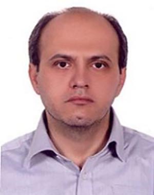
Masood Mashhadi Hossaiali is an associate professor in Geodesy at the Department of Geodesy and also dean of the Faculty of Geodesy and Geomatics Engineering of K.N. Toosi University of Technology. His professional interests are Deformation Modeling and Analysis, Satellite Geodesy and Signal Processing.
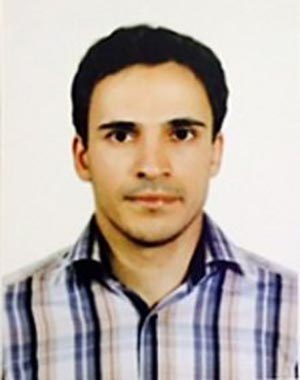
Ali Hosseininaveh is an assistant professor of the Dept. of Photogrammetry and Remote Sensing of the KNTU. He received a PhD in Photogrammetry from University College London (UCL) in 2014. He has been the head of the department of Photogrammetry and remote sensing since 2018. His research interests include robotics and machine vision, especially next best view planning, photogrammetry, accurate 3D measurement, 3D modelling, and point cloud geometry processing
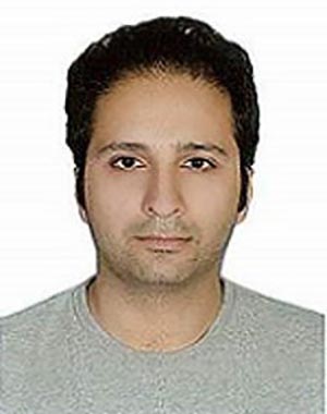
Hooman Latifi is assistant Professor at department of photogrammetry and remote Sensing of K. N. Toosi University of Technology and Associate Professor (PD) at Department of Remote Sensing of Julius-Maximilians-University Würzburg. He received his PhD from the Dept. of Remote Sensing and Landscape Information Systems of the University of Freiburg, Germany. His current research interests are forestry applications of LiDAR, UAV and time series optical data.
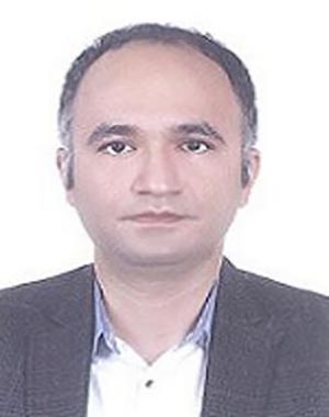
Ali Mohammadzadeh is associate professor abd vice- dean for research of the geomatics faculty. He has received his B.Sc., M.Sc. and Ph.D. from K.N.Toosi university of technology in 2000, 2002 and 2010 respectively. His main interests include Lidar and its applications, Artificial intelligence, Optimization and Optical remote sensing data analysis, Disaster Management (Fire, Earthquake, Flood, Dust & Pollution).
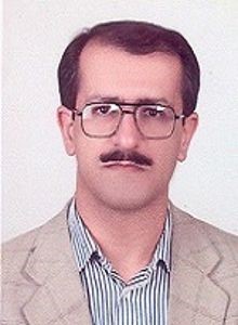
Mohammad Saadi Mesgari is an associate professor of the Dept. of GIS at the KNTU. He has received his M.Sc. degree in Geospatial Information Systems (GIS) for Cadastral Applications (1996) from ITC, The Netherlands, in 2000; and his Ph.D. in GIS from the University of Twente, the Netherlands, in 2000. He is also the head of the Center of Excellence in Geo-information Technology (under the authority of the Ministry of Science, Research and Technology (MSRT)), Board Member of the Iranian Scientific Association of Remote Sensing and GIS (MSRT),and Editorial Board Member of a number of scientific journals. His research interest include computational intelligence and its application in spatial issues; smart cities and spatially intelligent urban management; developing spatial database and GIS systems for different applications; LIS and Land Use Planning; and Spatial Data Infrastructure (SDI).
General Information
Period: 28-31 August
Location: K. N. Toosi University of Technology
Eligibility: Graduated, Professors, …
Course Language: English
Organized by: Faculty of Geodesy and Geomatics
Organizing Partner
- K. N. Toosi University of Technology
- Office of vice-chancellor for Global Strategies and International affairs
In case of Further Question please contact:
E-mail: Int_workshops@kntu.ac.ir
Phone: +98-21-88881003
Program Fee: 300$
The fee includes:
- educational courses
- meals
- accommodation in a hotel
- Trip to Hamedan
- Airport pick-up
- several social activities

